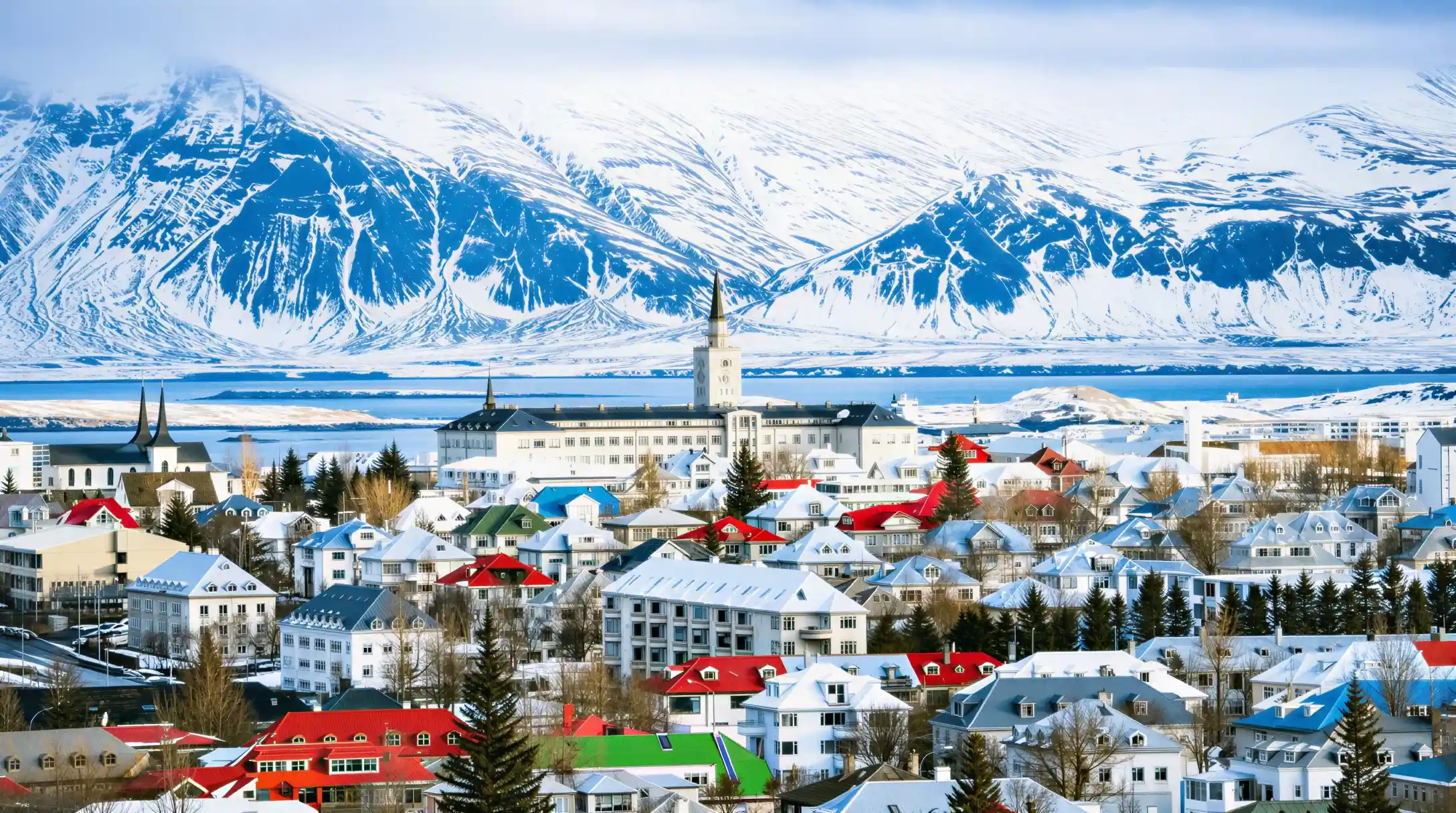
Most visitors guess wrong on the Reykjavik population before they land, usually low, because the city looks small on a map wedged between the sea and the highlands. The city proper holds 139,804 people, according to Statistics Iceland, and the wider capital region around it holds 253,230, a figure that matters more for anyone planning where to stay or how far a bus ride will run. That gap between the two numbers is the first thing this page settles: Reykjavik the city and Reykjavik the region are not the same count, and most travel writing blurs them into one. The pages linked from here go further into pronunciation, history and daylight; this one stays with what a traveller needs to know before booking anything, told in figures rather than impressions. A city this size behaves differently from the capitals visitors are used to. Distances downtown are short enough to walk, yet the region spreads wide enough that a hotel address ten minutes by car can still read as "Reykjavik" on a booking site. The rest of this page works through the numbers behind that, from the founding date to the climate to the roads in and out, so that the picture in a reader's head before arrival matches the one they find on the ground.
 Our pick
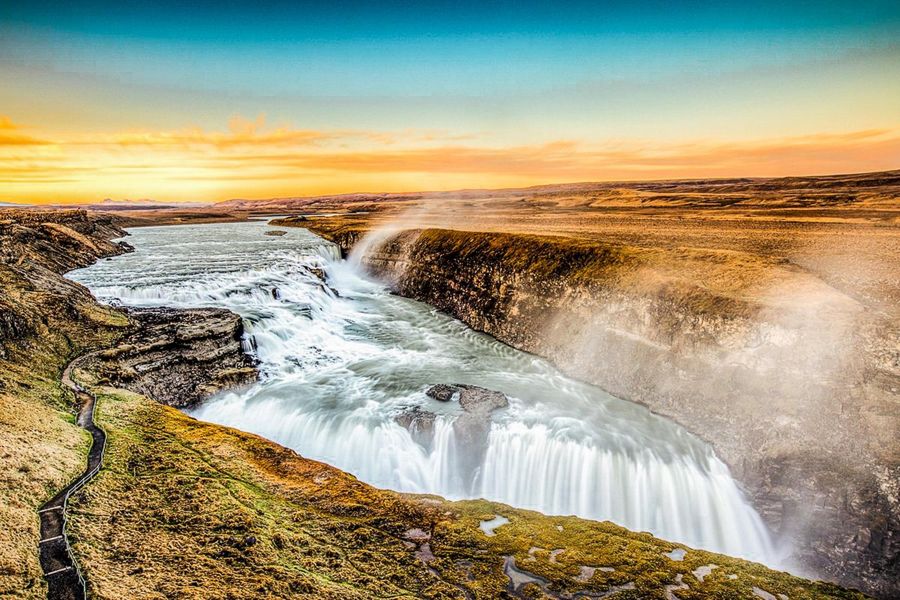
Reykjavik: Golden Circle Full-Day Tour with Kerid Crater
4.76/5 from 26,671 reviews · Golden Circle route with a stop at Kerid Crater · A first full day outside the city, covering the region's best-known route in one booking
4.76/5 from 26,671 reviews · Golden Circle route with a stop at Kerid Crater · A first full day outside the city, covering the region's best-known route in one booking
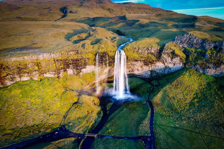
Reykjavik: South Coast Waterfalls, Black Sand & Glacier Tour
4.76/5 from 12,274 reviews · South coast waterfalls, black sand beach and glacier viewpoint · Travellers who want the coastline south of the capital region in a single day
4.76/5 from 12,274 reviews · South coast waterfalls, black sand beach and glacier viewpoint · Travellers who want the coastline south of the capital region in a single day
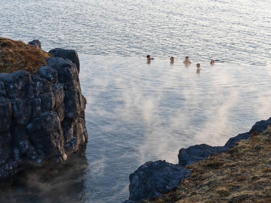
Reykjavik: Sky Lagoon Entrance Pass With 7-Step Spa Ritual
4.83/5 from 7,388 reviews · Entry to Sky Lagoon and the seven-step ritual · Anyone who wants to feel the city's geothermal water firsthand rather than just read about it
4.83/5 from 7,388 reviews · Entry to Sky Lagoon and the seven-step ritual · Anyone who wants to feel the city's geothermal water firsthand rather than just read about it
What the numbers actually say about the city
A reader who wants someone to tell me fun facts about Reykjavik usually expects trivia unconnected to anything useful, but the figures that matter here double as planning information. The city was granted its charter on 18 August 1786, according to Wikipedia, which makes it one of the newer capitals in Europe by charter date even though the site had been settled for centuries before that. Its area is 244 square kilometres (94 square miles), also per Wikipedia, spread over a landscape of inlets and low hills rather than packed into a dense core. That shape explains why the population figures need context: 139,804 people in the city proper is not a dense downtown count, it is a count spread across neighbourhoods that a visitor staying centrally may never see. The climate figures later on this page come from the same discipline of sourcing, each one dated and each one tied to a named station rather than a general impression of "cold" or "mild." Reykjavik's identity as a small, spread-out capital with a short official history but a long settlement one is the frame the rest of this page works within. None of these figures are static. Populations grow, boundaries occasionally shift and even weather averages update as records lengthen, so every number on this page carries the date it was checked rather than being presented as permanent. That habit is worth carrying into any other figure a reader meets while planning, whether it comes from this site or elsewhere.
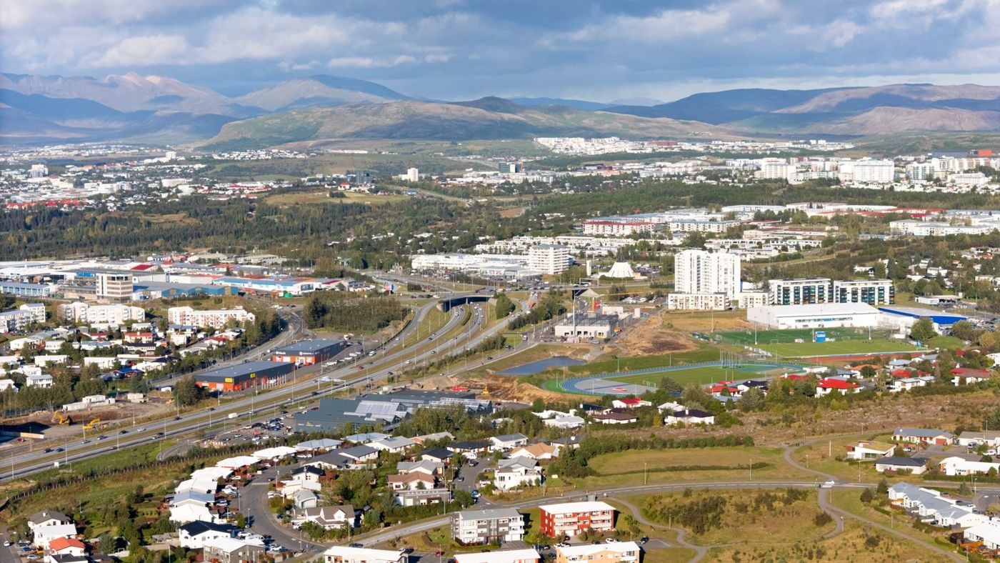
Identity beyond the population count
Searches for the Reykjavik flag usually come from people trying to place the city rather than the country, since Iceland's national flag, the blue, white and red cross, is the one most visitors already recognise from photographs. Reykjavik as a municipality has its own civic symbols used on official buildings and documents, distinct from the national flag flown across the country. That distinction, city versus nation, runs through most of what confuses first-time visitors: the city has its own council, its own boundaries and its own population count, all separate from Iceland's national totals. The charter of 1786 marked the point where Reykjavik became a formal town rather than a cluster of farms and a trading post, and everything that followed, including its civic identity, built on that starting point. A traveller who wants to understand the city's symbols is really asking a question about governance and history rather than design, and the honest answer is that Reykjavik functions as its own administrative unit inside Iceland, with its own council decisions covering everything from bus fares to swimming pool schedules. The practical version of this fact matters more than the visual one: policies that affect a visit, such as parking rules or public transport fares, are set at the city or municipal level, not decided nationally, which is worth remembering when a rule in Reykjavik does not match one read about elsewhere in Iceland.
The city count against the region count
Anyone asking how many people live in Reykjavik needs to decide first whether they mean the city or the region, because the two answers differ by more than eighty thousand people. Statistics Iceland counts 139,804 residents within the city proper, and 253,230 across the greater capital region that surrounds it, a distinction with real consequences for a visitor choosing where to book a hotel or how to read a map. A hotel listed as "Reykjavik" might sit in one of the surrounding municipalities that make up that larger regional figure rather than inside the city boundary itself, and the practical difference is usually a short bus or taxi ride rather than a long one. The regional figure also explains why the city can feel busier or quieter than its own headline population suggests: services, restaurants and attractions serve the whole capital region's population, not just the smaller number registered within city limits. When a travel guide or a booking site states a single population number for Reykjavik without saying which of the two it means, the honest response is to check both, since the gap between them is large enough to change expectations about crowding, transport and distance. This page uses the city figure and the regional figure side by side wherever population comes up, so the two are never confused for one another.
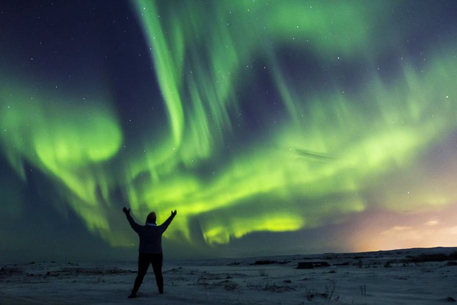
Reykjavik: Northern Lights Bus Tour with Hot Cocoa , 4.27/5 from 14,847 reviews. Includes a guided bus tour departing the capital region in search of the aurora, with hot cocoa provided. Best for visitors staying in the city who want an evening excursion without arranging transport themselves.
Life across the capital region
The phrase Reykjavik people covers a population spread more widely than the city's compact downtown suggests, since the 253,230 residents of the capital region live across several connected municipalities rather than a single urban block. Daily life for most of them runs on the same public services: Strætó operates the bus network across the region, with a single fare set at 690 ISK, a figure that applies whether a rider boards downtown or in one of the surrounding towns. That shared transport system is one of the clearest signs that the capital region functions as one connected area for its residents, even though official statistics separate the city count from the regional one. For a visitor, this means getting around does not require distinguishing between "Reykjavik" and its neighbouring towns in practice, since a single bus fare and a single network cover the whole area most people mean when they say they are visiting the capital. The climate residents experience is also regional rather than hyper-local: the Icelandic Meteorological Office records its figures at the Reykjavik station, and those readings describe conditions across the wider area rather than one specific street or neighbourhood. Understanding the city's population as one connected regional community, rather than a single dense city with empty land around it, makes sense of both the transport network and the way locals describe where they live.
Reykjavik's place as capital
The relationship between capital of iceland Reykjavik is straightforward on paper, Reykjavik is Iceland's capital and by far its largest urban area, but the scale involved surprises visitors used to larger countries. A national capital of 139,804 people, or 253,230 across the wider region, is small by the standards of most countries' capital cities, yet it still holds the seat of government, the country's main international gateway and the bulk of its cultural institutions. That combination, a small population carrying a capital's full range of functions, shapes how the city feels to visit: distances between major sites are short, but the range of things happening in that space, government, tourism, fishing industry, and services for the surrounding region, is not reduced by the smaller population. Keflavík Airport, Iceland's main gateway, sits outside the city itself, and the drive from the airport into downtown Reykjavik takes around 45 minutes, according to Flybus, the airport bus operator. That drive time is worth planning around, since it is longer than the population figures alone would suggest for a capital this size, largely because the airport was built at a distance from the city rather than immediately adjacent to it. Every visitor arriving by air experiences this gap between the airport and the capital before seeing any of the population or size figures discussed elsewhere on this page.
- Population, city proper
- 139,804
- Population, capital region
- 253,230
- Area of the city
- 244 km2 (94 sq mi)
- City charter granted
- 18 August 1786
- Main gateway airport
- KEF
- Airport to downtown drive time
- 45 min
Settling the population question
For anyone still asking what is the population of Reykjavik iceland after reading travel forums with conflicting numbers, the figures from Statistics Iceland, dated 2026-09-07, are 139,804 for the city proper and 253,230 for the greater capital region. Older figures circulate widely online and in guidebooks that were not recently updated, which is why this page states the date the count was checked rather than presenting the number as fixed. Population figures for any growing city move over time, and Reykjavik's growth means a number quoted a few years earlier is likely to undercount the current total. The distinction between city and region matters here as much as it did earlier on this page: a source quoting a lower figure may simply be using the city-proper count rather than the regional one, and a source quoting a higher figure may be counting the whole region or even a broader area still. When comparing Reykjavik's population to other cities, it helps to know which of the two Icelandic figures is being used, since comparing a regional count against another city's proper count produces a misleading result in either direction. This page's own figures are stated with their source and date precisely so a reader can check whether they still hold by the time of their trip.
Where the city sits
Questions about Reykjavik location usually come from people orienting themselves on a map for the first time, and the short answer is that the city sits on Iceland's southwest coast, built around a natural harbour with the capital region spreading along the coastline and inland from it. Keflavík Airport, the country's main international gateway, lies outside the city to the southwest, which is why the 45-minute drive time from the airport, cited by Flybus, is the first distance most visitors need to plan around before anything else. Getting from the airport into the city is possible by the Flybus service, priced from 3,999 ISK one way, by taxi, priced from around 22,500 ISK according to the Hreyfill taxi cooperative, or by rental car, each option putting a different weight on that same 45-minute distance. Reykjavik's coastal position also shapes its weather, recorded at the Icelandic Meteorological Office's Reykjavik station, and its role as a gateway to the rest of Iceland, since most road trips around the country begin from the capital region rather than the airport itself. Understanding where the city sits relative to the airport and the rest of the country is more useful for planning a trip than any map alone, since the practical distances, in minutes and in currency, are what actually shape an itinerary.
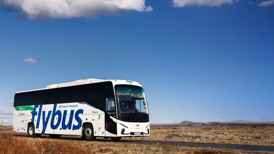
Keflavik Airport (KEF): Bus Transfer to/from Reykjavik , 4.66/5 from 20,988 reviews. Includes transfer between Keflavík Airport and the capital. Best for travellers who want the airport connection booked before they land rather than arranged on arrival.
The country behind the capital
For readers piecing together Reykjavik is the capital of which country from a search result rather than a map, the answer is Iceland, and the relationship between the two runs deeper than a simple label. Reykjavik holds the country's seat of government, its main airport connections through Keflavík, and the largest share of Iceland's population by a wide margin, with 253,230 people in the capital region against a much smaller population spread across the rest of the country. That concentration means most services a visitor needs, from tour operators to public transport to weather stations recording the country's most-cited climate data, are based in or near the capital. The Icelandic Meteorological Office's Reykjavik station is the reference point for the climate figures used throughout this page, and its position within the capital region is part of why those readings are treated as representative of the country's most visited area, even though conditions elsewhere in Iceland can differ sharply. Iceland as a country is far larger in land area than its capital region alone, but the practical reality for most visitors is that a trip begins and often returns to Reykjavik, making the relationship between city and country less a matter of geography trivia and more a matter of how an itinerary is built.
- January
- 3.2°C (37.8°F) · -1.7°C (28.9°F)
- June
- 13.0°C (55.4°F) · 7.2°C (45.0°F)
- July
- 14.9°C (58.8°F) · 9.1°C (48.4°F)
- December
- 3.3°C (37.9°F) · -1.6°C (29.1°F)
Measuring the city by size, not just population
The question how big is Reykjavik has two honest answers depending on whether it means area or population, and both are smaller than most visitors expect. By area, the city covers 244 square kilometres (94 square miles), a footprint spread thin rather than built up, which is part of why a city of 139,804 people can still feel like it has room to breathe. By population, the city proper's count sits well below what many national capitals hold, and even the capital region's 253,230 remains modest by international standards. Size in this case is less about scale and more about density: Reykjavik's low-rise character and spread-out neighbourhoods mean the same population that would fill a few dense blocks elsewhere is distributed across a much larger area here. Daylight is one more dimension of "how big" that catches visitors off guard, though it measures time rather than space: the city gets 21.2 hours of daylight around the June solstice and just 4.1 hours around the December solstice, according to Gaisma's sun-path almanac. That swing changes how much of the city and the region a visitor can realistically see in a day depending on the season, which matters as much for planning as the physical size of the place itself.
| Month | Average high | Average low |
|---|---|---|
| January | 3.2°C (37.8°F) | -1.7°C (28.9°F) |
| February | 3.3°C (37.9°F) | -1.9°C (28.6°F) |
| March | 4.2°C (39.6°F) | -1.3°C (29.7°F) |
| April | 6.9°C (44.4°F) | 1.0°C (33.8°F) |
| May | 10.1°C (50.2°F) | 4.0°C (39.2°F) |
| June | 13.0°C (55.4°F) | 7.2°C (45.0°F) |
| July | 14.9°C (58.8°F) | 9.1°C (48.4°F) |
| August | 14.1°C (57.4°F) | 8.6°C (47.5°F) |
| September | 11.4°C (52.5°F) | 6.2°C (43.2°F) |
| October | 7.6°C (45.7°F) | 2.7°C (36.9°F) |
| November | 4.7°C (40.5°F) | -0.1°C (31.8°F) |
| December | 3.3°C (37.9°F) | -1.6°C (29.1°F) |
- Average high
- 3.2°C (37.8°F)
- Average low
- -1.7°C (28.9°F)
- Average high
- 3.3°C (37.9°F)
- Average low
- -1.9°C (28.6°F)
- Average high
- 4.2°C (39.6°F)
- Average low
- -1.3°C (29.7°F)
- Average high
- 6.9°C (44.4°F)
- Average low
- 1.0°C (33.8°F)
- Average high
- 10.1°C (50.2°F)
- Average low
- 4.0°C (39.2°F)
- Average high
- 13.0°C (55.4°F)
- Average low
- 7.2°C (45.0°F)
- Average high
- 14.9°C (58.8°F)
- Average low
- 9.1°C (48.4°F)
- Average high
- 14.1°C (57.4°F)
- Average low
- 8.6°C (47.5°F)
- Average high
- 11.4°C (52.5°F)
- Average low
- 6.2°C (43.2°F)
- Average high
- 7.6°C (45.7°F)
- Average low
- 2.7°C (36.9°F)
- Average high
- 4.7°C (40.5°F)
- Average low
- -0.1°C (31.8°F)
- Average high
- 3.3°C (37.9°F)
- Average low
- -1.6°C (29.1°F)
Getting from the airport into the city
Keflavík Airport, the country's main gateway according to Isavia, sits roughly 45 minutes from downtown Reykjavik by road, a drive time confirmed by Flybus, the operator running the main airport bus service. Three ways to cover that distance carry published figures: the Flybus service, priced from 3,999 ISK one way, a taxi through the Hreyfill cooperative, priced from around 22,500 ISK, or a rental car, whose cost depends on the company and season and is not covered here. The gap between the bus fare and the taxi fare is large enough that most visitors travelling alone or in a small group choose the bus, while groups splitting a taxi fare several ways sometimes find the cost comparable once divided. None of these figures include the return trip, which should be budgeted separately and which some operators discount when booked as a round trip rather than two one-way fares. Once inside the city, the same Strætó network that serves the wider capital region also connects to the airport corridor, though the dedicated airport buses run a more direct route than the city bus system does. Planning the airport transfer before arrival, rather than deciding after landing, avoids the higher on-the-spot taxi rates that unplanned arrivals sometimes face at the terminal.
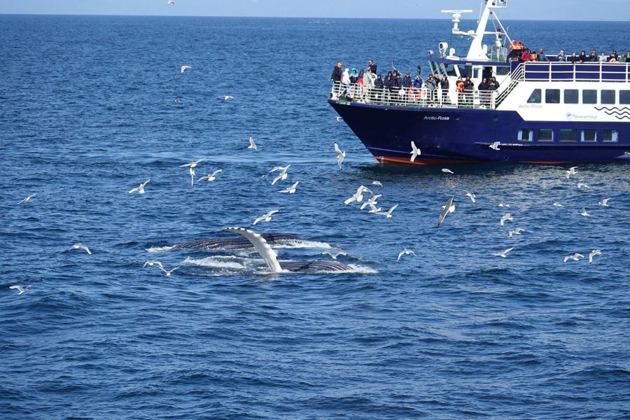
Reykjavik: Whale Watching and Marine Life Cruise , 4.50/5 from 11,217 reviews. Includes a guided boat tour departing the capital's harbour in search of whales and other marine life. Best for visitors who want to see the coastline that shapes the city's geography from the water itself.
The geothermal city
Reykjavik's name is often translated as "smoky bay," a reference to the geothermal steam early settlers saw rising from the ground around the harbour, and that same geothermal activity still shapes daily life across the capital region. The climate figures on this page describe air temperature, not ground heat, and the two are separate: even in a January with an average high of 3.2°C (37.8°F) and a low of -1.7°C (28.9°F), the city's geothermal water supply runs at a constant temperature drawn from underground rather than from the weather above. That resource underpins much of what visitors experience as distinctly Icelandic, from heated pavements in parts of the city to naturally warm swimming pools open through every season regardless of the air temperature outside. The region's position on active geological ground is also why Iceland monitors its geothermal and volcanic activity closely, though the specific conditions on the Reykjanes peninsula change often enough that any current status should be checked directly with the Icelandic Meteorological Office rather than assumed from a single page. What matters for a visit to the capital itself is simpler: the geothermal heat that gives Reykjavik its name is a constant background resource, running underneath a city whose air temperature swings from summer highs near 15°C (59°F) to winter lows below freezing.
Reykjavik: Golden Circle Full-Day Tour with Kerid Crater , 4.76/5 from 26,671 reviews. Includes the Golden Circle route with a stop at Kerid Crater. Best for a first day trip outside the capital region covering some of the country's most visited sites in one booking.
Planning around the figures on this page
Every number on this page carries a date because population counts, climate averages and transport fares all move, and a figure quoted without its date is a figure a reader cannot check. The population totals, 139,804 for the city and 253,230 for the capital region, come from Statistics Iceland as of 2026-09-07, and the same discipline applies to the transport fares: 690 ISK for a single Strætó bus fare, 3,999 ISK for a one-way Flybus ticket, and roughly 22,500 ISK for a taxi from Keflavík Airport, each figure current on the date it was recorded rather than fixed forever. Currency conversions are worth checking close to a trip rather than relying on a figure fixed months in advance, since ISK moves against USD and GBP like any other currency. The US State Department's travel information for Iceland and the UK FCDO's travel advice for Iceland are the two starting points for entry rules and safety updates before a trip, since both are updated more frequently than any static guide page can match. For anything about the weather itself, from a daily forecast to an aurora outlook, the Icelandic Meteorological Office publishes current data rather than fixed averages, and it is the source behind the climate figures used throughout this page. Checking these sources directly close to a travel date is the surest way to confirm that a figure written here still holds by the time of arrival.
Common questions
Is the Reykjavik population figure the city or the whole region?
Statistics Iceland records 139,804 people in the city proper and 253,230 across the greater capital region, and the two figures are commonly confused with one another.
How far is Keflavík Airport from downtown Reykjavik?
Around 45 minutes by road, according to Flybus, which also runs the main airport bus service between the two.
What does Reykjavik's geothermal heat actually supply?
A constant underground heat source used across the capital region for hot water and heated pools, separate from the air temperature recorded at the Icelandic Meteorological Office's Reykjavik station.
Is Reykjavik a big city by international standards?
No, its area is 244 km2 (94 sq mi) and its population is modest even at the regional count of 253,230, though it holds the full range of a national capital's functions.
When was Reykjavik's city charter granted?
18 August 1786, according to Wikipedia, marking the point the settlement became a formally chartered town.