Reykjavík: Volcano Eruption Site and Reykjanes Hiking Tour
- Pickup from your hotel
- Guide works in English
- Duration per the operator: 9 hours
Nine hours from Reykjavik to the Reykjanes eruption sites
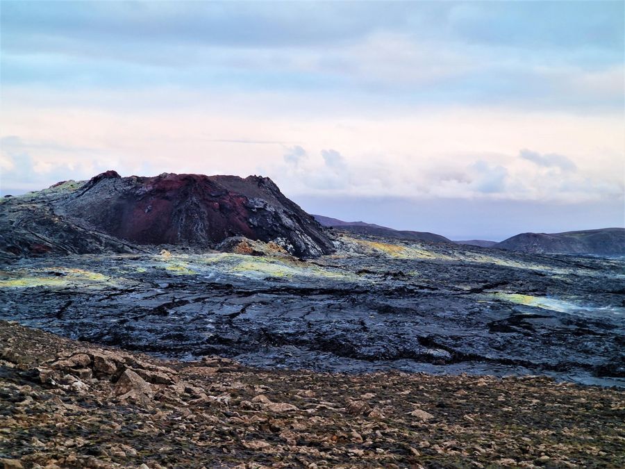
This tour takes you out of Reykjavik for a full day on the Reykjanes peninsula, where the recent volcanic activity has reshaped the landscape. The route runs roughly 45 km (28 miles) southwest from the city, and the 9-hour duration leaves room for the long drive, the hike to the eruption site, and the other stops along the way. The tour is led by an English-speaking guide and includes hotel pickup, so you do not need to make your own way to a meeting point. It is a practical choice for travellers who want to see the new lava fields without renting a car or navigating the peninsula's roads themselves. The itinerary also touches Vík í Mýrdal, which stretches the day considerably, so expect a long but full outing rather than a quick look at the volcano.
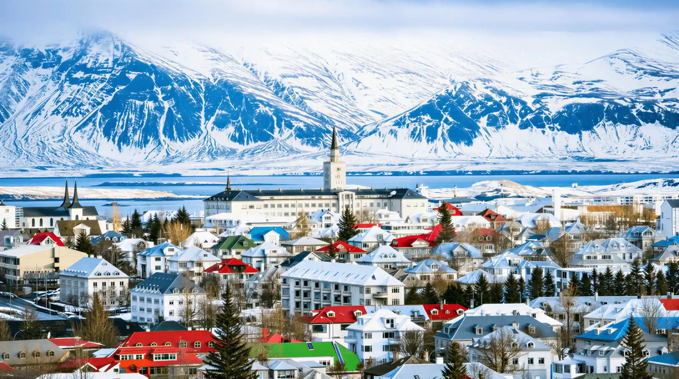
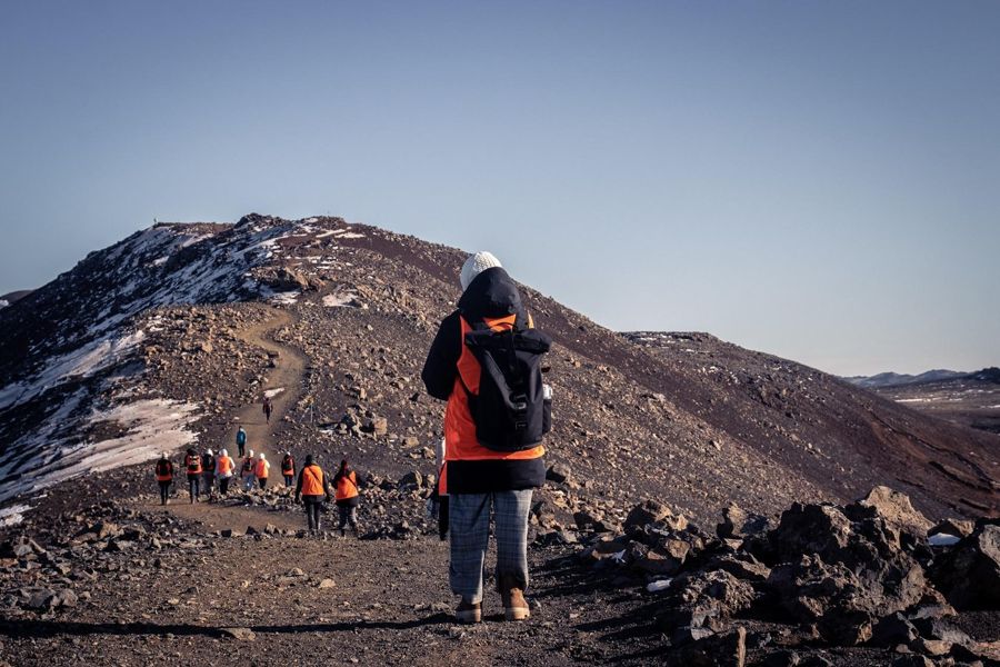
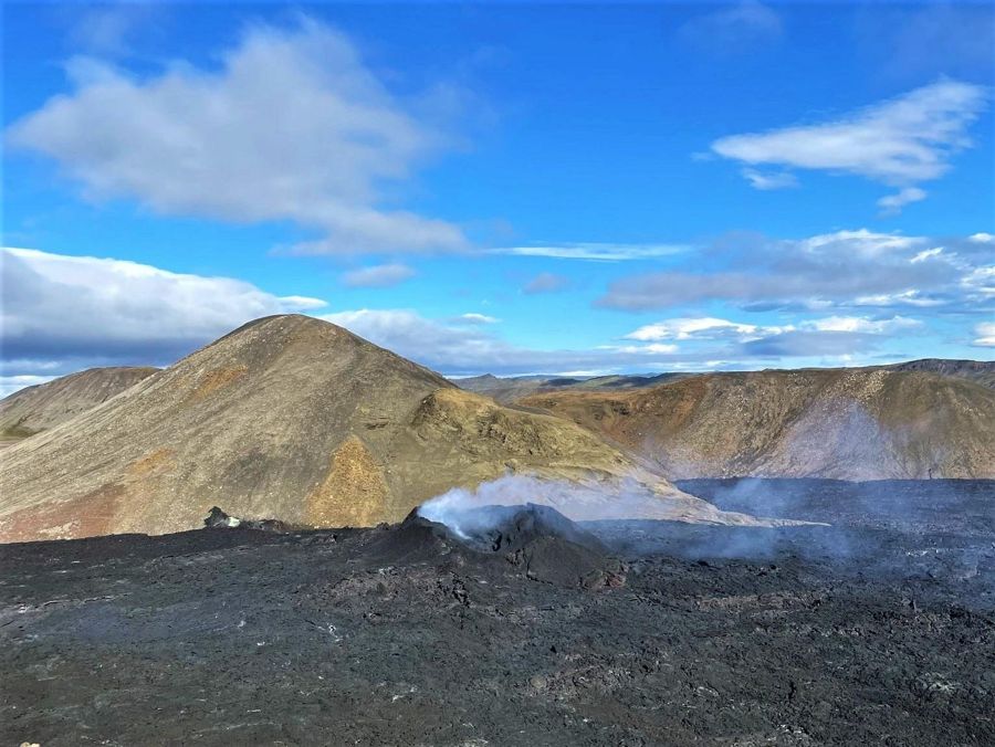
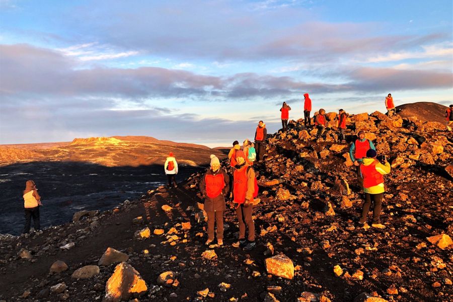
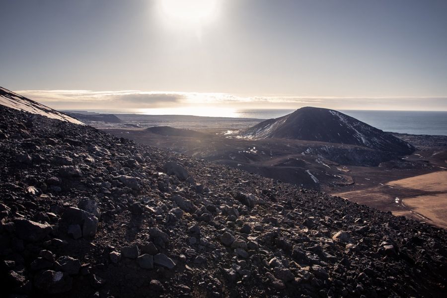
Photographs from the operator BusTravel Iceland. They show the listing, not your day.
- Operator
- BusTravel Iceland
- Duration
- 9 hours
- Departure point
- Reykjavik
- Group form
- group
- Guiding
- guide
- In English
- yes
- Pickup from your hotel
- yes
- Price
- from $132
- Rating
- 4.6 from 1,154 ratings
- Quality bar
- passed
What is included, what is not, and what the operator does not say
The catalogue distinguishes three states, and the third matters most: not stated does not mean excluded, it means unresolved.
| Service | Status | What that means for you |
|---|---|---|
| Admission to the site | not stated | admission not stated |
| Pickup from your hotel | included | Included, the meeting point is where you are staying. |
| Food on the tour | not included | Not included. |
- Status
- not stated
- What that means for you
- admission not stated
- Status
- included
- What that means for you
- Included, the meeting point is where you are staying.
- Status
- not included
- What that means for you
- Not included.
What the 132 USD covers and what it does not
The entry price starts at 132 USD, which places this tour among the more affordable options in its category. That price covers your transport from Reykjavik, the guide, and the planned stops. Hotel pickup is explicitly part of the deal, so you do not need to factor in a separate transfer to a departure point. Food is not included in the price, and the operator does not offer it as an add-on either. You should bring your own lunch and snacks for the day, since the schedule is long and the stops are not built around meal breaks. The only official extra you may encounter is a parking fee of 1,000 ISK at the eruption-site trailheads, charged at the P1 and P2 car parks. This fee is set by the site, not by the operator, and it applies if you arrive by the tour's vehicle. No admission is charged at any of the places on the itinerary, and no other gate costs apply. The tour is not wheelchair accessible, so if that is a requirement for you, this is not the right fit.
The price in context
The starting price of this tour against the 4 best-evidenced listings in the same category that publish one. The highlighted bar is this tour.
Prices are the lowest bookable option, not the one that will necessarily suit you.
The figures behind this chart, as a table
| Row | Reykjavík: Volcano Eruption Site and R… | Reykjavik: LAVA SHOW - Immersive Exper… | Reykjavík: Guided Afternoon Hiking Tou… | From Reykjavik: Raufarhólshellir Lava … | From Reykjavik: Raufarhólshellir Lava … |
|---|---|---|---|---|---|
| Starting price | 132 $ | 53 $ | 132 $ | 67 $ | 153 $ |
This tour against 4 comparable ones
All 5 come from the category “Volcano and lava tours”. The column for this tour is highlighted; the others are the best-evidenced in the category.
| Reykjavík: Volcano Eruption Site and Reykjanes … | Reykjavik: LAVA SHOW - Immersive Experience Entry … | Reykjavík: Guided Afternoon Hiking Tour to New … | From Reykjavik: Raufarhólshellir Lava Tunnel Tour | From Reykjavik: Raufarhólshellir Lava Tunnel by Bus | |
|---|---|---|---|---|---|
| Provider | BusTravel Iceland | Icelandic Lava Show | BusTravel Iceland | Arctic Adventures | ICELANDIA |
| Price | from 132 $ | from 53 $ | from 132 $ | from 67 $ | from 153 $ |
| Duration | 9 hours | 1.2 hours | 7 hours | 1 to 3 hours | 3 hours |
| Group type | group | group | group | group | group |
| In English | yes | yes | yes | yes | yes |
| Admission | not stated | not stated | included | not stated | not stated |
| Pickup | yes | not stated | not stated | not stated | no |
| Rating (reviews) | 4.6 (1,154) | 4.7 (4,030) | 4.4 (942) | 4.7 (852) | 4.6 (850) |
| Quality floor | above the floor | above the floor | above the floor | above the floor | above the floor |
| Free cancellation until | not stated | not stated | not stated | not stated | not stated |
- Provider
- BusTravel Iceland
- Price
- from 132 $
- Duration
- 9 hours
- Group type
- group
- In English
- yes
- Admission
- not stated
- Pickup
- yes
- Rating (reviews)
- 4.6 (1,154)
- Quality floor
- above the floor
- Free cancellation until
- not stated
- Provider
- Icelandic Lava Show
- Price
- from 53 $
- Duration
- 1.2 hours
- Group type
- group
- In English
- yes
- Admission
- not stated
- Pickup
- not stated
- Rating (reviews)
- 4.7 (4,030)
- Quality floor
- above the floor
- Free cancellation until
- not stated
- Provider
- BusTravel Iceland
- Price
- from 132 $
- Duration
- 7 hours
- Group type
- group
- In English
- yes
- Admission
- included
- Pickup
- not stated
- Rating (reviews)
- 4.4 (942)
- Quality floor
- above the floor
- Free cancellation until
- not stated
- Provider
- Arctic Adventures
- Price
- from 67 $
- Duration
- 1 to 3 hours
- Group type
- group
- In English
- yes
- Admission
- not stated
- Pickup
- not stated
- Rating (reviews)
- 4.7 (852)
- Quality floor
- above the floor
- Free cancellation until
- not stated
- Provider
- ICELANDIA
- Price
- from 153 $
- Duration
- 3 hours
- Group type
- group
- In English
- yes
- Admission
- not stated
- Pickup
- no
- Rating (reviews)
- 4.6 (850)
- Quality floor
- above the floor
- Free cancellation until
- not stated
The order follows the weight of evidence and not the commission. Every value comes from the same catalogue fields, so that the columns compare.
How many people have judged it?
The number of ratings per listing, the score in brackets. A score without the population behind it tells you nothing.
This site's quality bar sits at ten ratings. Below that is not a verdict, it is chance.
The figures behind this chart, as a table
| Row | Reykjavík: Volcano Eruption Si… (4.6) | Reykjavik: LAVA SHOW - Immersi… (4.7) | Reykjavík: Guided Afternoon Hi… (4.4) | From Reykjavik: Raufarhólshell… (4.7) | From Reykjavik: Raufarhólshell… (4.6) |
|---|---|---|---|---|---|
| Ratings | 1,154 ratings | 4,030 ratings | 942 ratings | 852 ratings | 850 ratings |
A score backed by more than a thousand reviews
The tour holds a rating of 4.6 out of 5, and that score comes from 1,154 reviews. That is a substantial base, and it is the second-highest number of reviews among the 41 volcano tours in this category. Only one other listing in the group has more people weighing in, which means this rating is not a thin sample. A 4.6 from over a thousand travellers is a solid signal that the experience matches what is promised. In terms of price, this tour ranks sixth cheapest out of the 41, putting it in the most affordable 15 percent of the group, where prices range from 24 USD to over 4,000 USD. So you are getting a well-reviewed tour at a price that sits well below the middle of the pack. That combination of broad feedback and a low price makes it a strong value proposition, though the long duration and the distance to Vík mean it is not the most efficient use of a day if you only care about the volcano itself.
The day, stop by stop
The order follows the usual run of the day. Each stop names what is there and the figures behind it; everything else is in the data sheet.
Pickup where you are staying
The operator collects you; the stated duration counts from here, not from the first stop.
Reykjavik
- Population of Reykjavik (city proper)139,804Statistics Iceland
- Daylight on the June solstice21.2 hGaisma (sun-path almanac)
- Daylight on the December solstice4.1 hGaisma (sun-path almanac)
Vík í Mýrdal
- Road distance from Reykjavik186.9 kmOpenStreetMap road network, routed with OSRM
- Driving time from Reykjavik167 minOpenStreetMap road network, routed with OSRM
- Average annual rainfall2,333 mmIcelandic Meteorological Office (Veðurstofa Íslands)
Reykjanes peninsula
- Current volcanic statusNo active eruption; magma still accumulating beneath SvartsengiIcelandic Meteorological Office
- Parking fee at the eruption-site trailheads (P1/P2)1,000 ISKVisit Reykjanes
- Volcanic gas pollution warningGas pollution near eruption sites can still exceed safe thresholds even without active eruption; visitors should check the air-quality/gas forecast before hikingIcelandic Meteorological Office
Back to where you started
Back to the full list
A place on this list is a stop, not a promise about how long you spend there.
Temperatures in Reykjavik across the year
Mean daily high and mean daily low per month. Two series, one axis; the points mark the warmest and the coolest month.
There is little shelter at most of these sites. The figures are long-run outdoor averages and not a forecast.
The figures behind this chart, as a table
| Row | Jan | Feb | Mar | Apr | May | Jun | Jul | Aug | Sep | Oct | Nov | Dec |
|---|---|---|---|---|---|---|---|---|---|---|---|---|
| Daily high | 3.2 degrees C | 3.3 degrees C | 4.2 degrees C | 6.9 degrees C | 10.1 degrees C | 13 degrees C | 14.9 degrees C | 14.1 degrees C | 11.4 degrees C | 7.6 degrees C | 4.7 degrees C | 3.3 degrees C |
| Daily low | -1.7 degrees C | -1.9 degrees C | -1.3 degrees C | 1 degrees C | 4 degrees C | 7.2 degrees C | 9.1 degrees C | 8.6 degrees C | 6.2 degrees C | 2.7 degrees C | -0.1 degrees C | -1.6 degrees C |
When the weather cooperates with the long drive
Reykjavik's temperatures peak in July at 15 degrees Celsius (59 degrees Fahrenheit) and stay above 10 degrees from June through September. The tour runs for nine hours, most of it outdoors on the peninsula, so the warmer months are the practical window. In May, highs reach 10 degrees and lows sit at 4 degrees, which is workable but calls for layers. June through August is the sweet spot, with highs between 13 and 15 degrees and lows that do not drop below 7 degrees. The shoulder months of April and October are cooler, with highs of 7 and 8 degrees respectively, and the wind on the exposed Reykjanes peninsula will make those temperatures feel sharper. From November to March, highs hover around 3 to 5 degrees and lows fall below freezing, which makes a nine-hour outdoor day uncomfortable at best. The daylight hours also matter: in winter the sun is up for only a few hours, which would leave much of the tour in darkness. Plan for the period between May and September, and start early in the day to make the most of the light.
The full data sheet
Everything below comes from the operator's own catalogue entry or from the sources named in the last column. Where a field is blank, the operator did not fill it in, and that is recorded as unstated rather than guessed.
Download the full table as CSV · 112 rows
Show all 112 figures
| Fact | Value | Source |
|---|---|---|
| The listing27 | ||
| Operator's own title | Reykjavík: Volcano Eruption Site and Reykjanes Hiking Tour | GetYourGuide catalogue |
| Operator | BusTravel Iceland | GetYourGuide catalogue |
| Product number | 398264 | GetYourGuide catalogue |
| Departure point | Reykjavik | GetYourGuide catalogue |
| Duration | 9 hours | GetYourGuide catalogue |
| Multi-day | no | GetYourGuide catalogue |
| Starting price | $132 | GetYourGuide, live check |
| Starting price in local currency | about 15,992 ISK | Rate 121.15 ISK to the USD |
| Rating | 4.6 out of 5 | GetYourGuide, live check |
| Number of ratings | 1,154 | GetYourGuide, live check |
| This project's quality bar | passed | Own rule: at least 4.0 from at least 10 ratings |
| Rank within its category | 2 of 41 in “Volcano and lava tours” | Own analysis, score weighted by the number of ratings |
| Admission to the site | not stated | GetYourGuide catalogue |
| Food on the tour | not included | GetYourGuide catalogue |
| Pickup from your hotel | included | GetYourGuide catalogue |
| Kind of guiding | guide | GetYourGuide catalogue |
| Guiding languages | English | GetYourGuide catalogue |
| Guide works in English | yes | GetYourGuide catalogue |
| Bookable privately | no | GetYourGuide catalogue |
| Small group | no | GetYourGuide catalogue |
| Group form per the operator | not stated | GetYourGuide catalogue |
| Priority entry | no | GetYourGuide catalogue |
| Suitable for wheelchair users | not stated | GetYourGuide catalogue |
| Free cancellation | yes | GetYourGuide catalogue |
| Cancellation deadline | not stated | GetYourGuide catalogue |
| Basis in the catalogue | not stated | Own check of the catalogue fields |
| Operator's images | 5 photographs | GetYourGuide catalogue |
| Reykjavik37 | ||
| Population of Reykjavik (city proper) | 139,804 | Statistics Iceland |
| Population of the greater capital region | 253,230 | Statistics Iceland |
| Area of the city | 244 km2 | Wikipedia |
| City charter granted | 18 August 1786 | Wikipedia |
| Weather station for the climate figures below | Reykjavík station (station no. 1), Icelandic Meteorological Office | Icelandic Meteorological Office (Veðurstofa Íslands) |
| Average high in January | 3.2 °C | Icelandic Meteorological Office |
| Average high in February | 3.3 °C | Icelandic Meteorological Office |
| Average high in March | 4.2 °C | Icelandic Meteorological Office |
| Average high in April | 6.9 °C | Icelandic Meteorological Office |
| Average high in May | 10.1 °C | Icelandic Meteorological Office |
| Average high in June | 13 °C | Icelandic Meteorological Office |
| Average high in July | 14.9 °C | Icelandic Meteorological Office |
| Average high in August | 14.1 °C | Icelandic Meteorological Office |
| Average high in September | 11.4 °C | Icelandic Meteorological Office |
| Average high in October | 7.6 °C | Icelandic Meteorological Office |
| Average high in November | 4.7 °C | Icelandic Meteorological Office |
| Average high in December | 3.3 °C | Icelandic Meteorological Office |
| Average low in January | -1.7 °C | Icelandic Meteorological Office |
| Average low in February | -1.9 °C | Icelandic Meteorological Office |
| Average low in March | -1.3 °C | Icelandic Meteorological Office |
| Average low in April | 1 °C | Icelandic Meteorological Office |
| Average low in May | 4 °C | Icelandic Meteorological Office |
| Average low in June | 7.2 °C | Icelandic Meteorological Office |
| Average low in July | 9.1 °C | Icelandic Meteorological Office |
| Average low in August | 8.6 °C | Icelandic Meteorological Office |
| Average low in September | 6.2 °C | Icelandic Meteorological Office |
| Average low in October | 2.7 °C | Icelandic Meteorological Office |
| Average low in November | -0.1 °C | Icelandic Meteorological Office |
| Average low in December | -1.6 °C | Icelandic Meteorological Office |
| Average annual precipitation | 875.9 mm | Icelandic Meteorological Office |
| Daylight on the June solstice | 21.2 h | Gaisma (sun-path almanac) |
| Daylight on the December solstice | 4.1 h | Gaisma (sun-path almanac) |
| Main gateway airport | KEF | Isavia |
| Drive time from Keflavik Airport to downtown Reykjavik | 45 min | Flybus (Kynnisferðir) |
| Single city bus fare (Strætó) | 690 ISK | Strætó bs |
| One-way airport bus fare (Flybus, KEF to Reykjavik) | 3,999 ISK | Flybus (Kynnisferðir) |
| Taxi fare from Keflavik Airport to Reykjavik | 22,500 ISK | Hreyfill (taxi cooperative) |
| Vík í Mýrdal19 | ||
| Population, Vík í Mýrdal locality | 740 | Statistics Iceland (Hagstofa Íslands), table MAN030102 |
| Population, Mýrdalshreppur municipality | 1,004 | Statistics Iceland (Hagstofa Íslands), table MAN02005 |
| Population passed 1,000 for the first time | Mýrdalshreppur's municipal population rose from 881 (2024) to 965 (2025) to 1,004 (2026), the first time it has passed 1,000 | Statistics Iceland (Hagstofa Íslands), table MAN02005 |
| Municipality area | 755 km2 | Wikipedia |
| Church doubles as flood evacuation point | Standing on high ground above the village, Víkurkirkja is considered one of the few buildings likely to survive a Katla-triggered glacial flood, and serves as the village's designated evacuation point | Wikipedia |
| Katla volcano, last eruption through the ice cap | 1918 (started 12 October, lasted 24 days) | Icelandic Meteorological Office (Veðurstofa Íslands) |
| Katla's historical eruption interval | About every 50 years on average from Iceland's settlement until 1918; over 100 years have now passed since the last eruption broke through the ice | Icelandic Meteorological Office (Veðurstofa Íslands) |
| Official Katla/Eyjafjallajökull civil-protection response plan | 30 September 2017 | Almannavarnir (Icelandic Civil Protection) |
| Evacuation response time built into the Katla plan | 15-20 min for Sólheimabær, up to 30 min elsewhere in the hazard zone; seismic monitoring may give 4-6 hours' warning before an eruption starts | Almannavarnir (Icelandic Civil Protection) |
| Official rockfall/snow-avalanche hazard assessment for the town | Confirmed by the Minister for the Environment on 10 February 2010, based on Veðurstofa Íslands fieldwork carried out in 2008-2009 | Icelandic Meteorological Office (Veðurstofa Íslands) |
| Average annual rainfall | 2,333 mm | Icelandic Meteorological Office (Veðurstofa Íslands) |
| Wettest year on record | 2,887 mm | Icelandic Meteorological Office (Veðurstofa Íslands) |
| Single-day rainfall record | 150.3 mm | Icelandic Meteorological Office (Veðurstofa Íslands) |
| Highest temperature on record | 28.5 C | Icelandic Meteorological Office (Veðurstofa Íslands) |
| Lowest temperature on record | -16.9 C | Icelandic Meteorological Office (Veðurstofa Íslands) |
| Ranking among Iceland's weather stations | One of Iceland's two warmest weather stations for the year as a whole, together with Vestmannaeyjar | Icelandic Meteorological Office (Veðurstofa Íslands) |
| Hotel rooms in the village | 1,400 | Wikipedia |
| Road distance from Reykjavik | 186.9 km · Computed over the OpenStreetMap road network, not quoted from a tour operator. Driving only: no stops, no ferry, no winter closures, and a car rather than a coach that has to load forty people at every stop. | OpenStreetMap road network, routed with OSRM |
| Driving time from Reykjavik | 167 min · Computed over the OpenStreetMap road network, not quoted from a tour operator. Driving only: no stops, no ferry, no winter closures, and a car rather than a coach that has to load forty people at every stop. | OpenStreetMap road network, routed with OSRM |
| Reykjanes peninsula29 | ||
| Road distance, Reykjavik to Keflavik Airport | 50 km | Grayline Iceland |
| Drive time, Reykjavik to Keflavik Airport | 45 min | Grayline Iceland |
| Parking fee at the eruption-site trailheads (P1/P2) | 1,000 ISK | Visit Reykjanes |
| Reykjanes UNESCO Global Geopark, designated | 2,015 | UNESCO |
| Reykjanes UNESCO Global Geopark area | 818 km2 | UNESCO |
| Reykjanes UNESCO Global Geopark, resident population | 29,100 | UNESCO |
| Number of geosites in the geopark | 55 | Reykjanes Geopark |
| Plate spreading rate across the peninsula | 2.0-2.5 cm/year | Reykjanes Geopark |
| Dike intrusion preceding the 2021 Fagradalsfjall eruption | 24 February - 19 March 2021 | Icelandic Meteorological Office |
| Fagradalsfjall (Geldingadalir) eruption, 2021 | 19 March - about 18 September 2021 | Icelandic Meteorological Office |
| Meradalir eruption, 2022 | 3-21 August 2022 | Icelandic Meteorological Office |
| Litli-Hrútur eruption, 2023 | 10 July - about 5-6 August 2023 | Icelandic Meteorological Office |
| Number of eruptions on the Sundhnúkur crater row since December 2023 | 9 | Icelandic Meteorological Office |
| First Sundhnúkur crater row eruption | 18-21 December 2023 | Icelandic Meteorological Office |
| Ninth (most recent) Sundhnúkur crater row eruption | 16 July - 4/5 August 2025 | Icelandic Meteorological Office |
| Current volcanic status | No active eruption; magma still accumulating beneath Svartsengi | Icelandic Meteorological Office |
| Grindavík evacuation date | 10-11 November 2023 | Reuters via Euronews |
| Grindavík town reopened to the public | 21 October 2024 | Icelandic Tourist Board (Ferðamálastofa) |
| Most residents remain displaced despite reopening | About 1,200 of roughly 3,800 original residents were still registered Grindavík residents as of January 2025; over 950 homes (90%+) bought out by the state company Þórkatla | Springer Nature (Natural Hazards journal) |
| Road 43 to the Blue Lagoon fully reopened | 15 December 2024 | Icelandic tourism press reporting (aggregated) |
| Ground cracks near the Bridge Between Continents and Valahnúkur | Reykjanes Geopark warns of visible ground cracks and advises caution at Valahnúkur and the Bridge Between Continents area | Reykjanes Geopark |
| Safety warning on fresh lava fields | Never walk on the lava; the crust can be thin over still-hot lava underneath, and edges are sharp | Safetravel (Icelandic Association for Search and Rescue) |
| Volcanic gas pollution warning | Gas pollution near eruption sites can still exceed safe thresholds even without active eruption; visitors should check the air-quality/gas forecast before hiking | Icelandic Meteorological Office |
| Entry to Gunnuhver hot springs / mud pools | 0 ISK | Visit Reykjanes |
| Gunnuhver's largest mud pool, width | 20 m | Visit Reykjanes |
| Wheelchair access at Gunnuhver | Two ramps, one to the main spring and one to the Kísilhól silica hill viewpoint | Visit Reykjanes |
| Safety warning at Brimketill | Unsupervised site; sneaker waves can surge over the rock wall and drag people into the sea, and surrounding lava rock is sharp and often slippery | Visit Reykjanes |
| Road distance from Reykjavik | 66.9 km · Computed over the OpenStreetMap road network, not quoted from a tour operator. Driving only: no stops, no ferry, no winter closures, and a car rather than a coach that has to load forty people at every stop. | OpenStreetMap road network, routed with OSRM |
| Driving time from Reykjavik | 70 min · Computed over the OpenStreetMap road network, not quoted from a tour operator. Driving only: no stops, no ferry, no winter closures, and a car rather than a coach that has to load forty people at every stop. | OpenStreetMap road network, routed with OSRM |
What happens when you reach the eruption site
The tour's main stop is the eruption site on the Reykjanes peninsula, where you will park at one of the designated trailheads, P1 or P2. From there, a path leads toward the lava field. The site is open and exposed, so the weather plays a large role in what you see and how long you can stay. Rain and wind are common on the peninsula, and visibility can drop quickly, which can shorten the time at the site. The guide decides when to turn back based on conditions, and that call is made for safety rather than to cut the tour short. There is no visitor centre or staffed building at the trailhead, so you should be prepared to be outside for the duration of the stop. The parking fee of 1,000 ISK is collected at the car park, and the guide handles that as part of the tour. After the eruption site, the tour continues toward Vík í Mýrdal, which adds a significant stretch of driving to the day.
Who this day suits, and who should look elsewhere
This tour is for travellers who want to see the new volcanic landscape in person and are comfortable with a long day that includes a considerable amount of driving. The nine-hour duration and the detour to Vík mean you should be happy to spend a good part of the day on the road. It suits hikers who are prepared for uneven terrain and changeable weather. If you are short on time or prefer a more focused experience, the Guided Afternoon Hiking Tour to New Volcano Site runs for seven hours and is a shorter alternative that stays closer to the eruption area. That tour also starts from 132 USD and has a rating of 4.4 from 942 reviews, so it is a comparable but more compact option. If you would rather see volcanic geology without the hike, the Raufarhólshellir Lava Tunnel Tour offers a 1 to 3 hour underground walk for from 67 USD, rated 4.7 from 852 reviews. This Reykjanes tour is not for anyone with limited mobility, since it is not wheelchair accessible and the eruption site involves walking on rough ground.
Similar tours on this site
Six listings a reader of this page is genuinely torn between: same departure point first, then the same destinations, then a similar length. Each card leads to a page with the same data sheet rather than straight to the operator, so you can compare before you book.
Reykjavík: Volcano Hike, Visit Grindavík and Blue Lagoon
9 hoursICELANDIA
4.519 reviews
- English-speaking guide
- Admission included
from $375To the page
From Reykjavik: Volcano Hike, Reykjanes Geopark & Sky Lagoon
11 hoursICELANDIA
4.621 reviews
- English-speaking guide
- Admission included
from $354To the page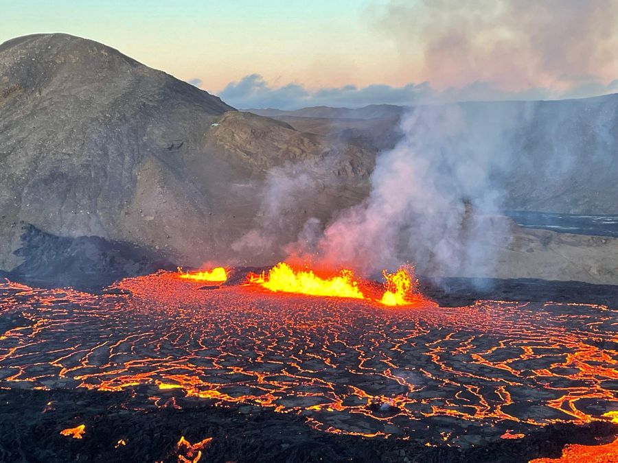
Reykjavik: Private Volcano Eruption Site & Reykjanes Tour
8 hoursKalman Tours
no reviews yet
- English-speaking guide
- Hotel pickup
from $1430To the page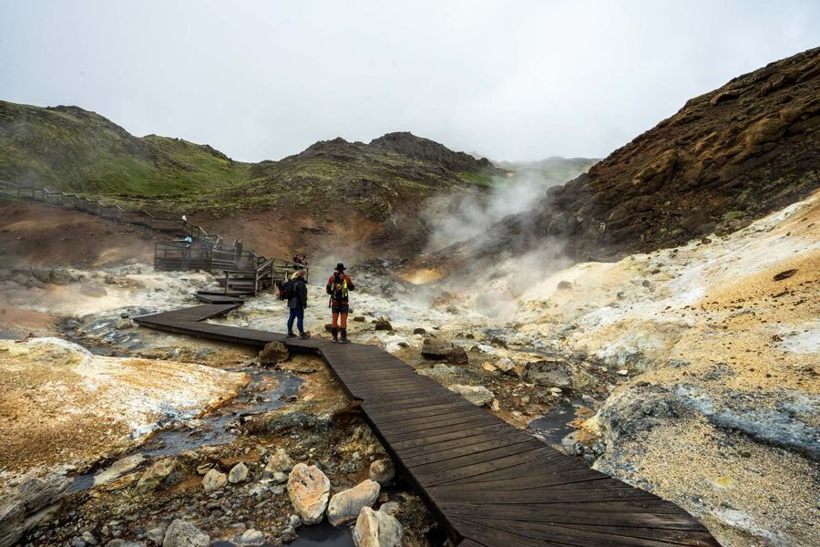
Reykjavík: Volcanoes, Grindavík, Hot Springs, & Lava Tour
7 hoursGlaciers and Waterfalls ehf
4.7149 reviews
- English-speaking guide
- Hotel pickup
from $122To the page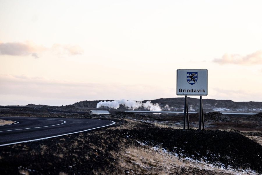
Reykjavik: Guided Tour to Volcano and Reykjanes Geopark
7 hoursICELANDIA
4.4446 reviews
- English-speaking guide
from $133To the page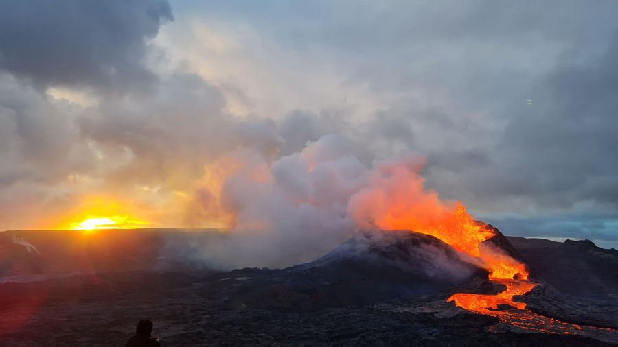
From Reykjavík: Fagradalsfjall Volcano Hike with Geologist
4 to 6 hoursGeoadventures ehf
4.8840 reviews
- English-speaking guide
from $159To the page
The order follows how close a listing is to this one, not the commission. Ratings, prices and availability according to GetYourGuide, accessed on . Prices in US dollars; “from” is the provider's lowest entry price.
Common questions
Is admission included?
The catalogue does not say. Where the route is waterfalls and beaches there is nothing to pay; ask if it includes a paid attraction.
How long does the tour really take?
The catalogue gives 9 hours. That is the operator's own figure and covers the tour itself, not the time you spend getting to the meeting point.
Is there a guide who works in English?
Yes, the operator lists English as a guiding language. That is the operator's commitment, not a checked property of the person on the day.
Where do I find all the data on this tour?
In the data sheet on this page. It carries every field on the tour, on each place it visits and on the climate of the departure city, each with its source, and it downloads as a CSV.
Does this listing's rating mean anything?
Yes. 4.6 out of 5 from 1,154 is above the bar this site holds, which is 4.0 out of 5 from at least ten voices.
Reykjavík: Volcano Eruption Site and Reykjanes Hiking Tour
Dates, remaining places and the current version of what is included are at the operator. This page reflects the state of the catalogue, not the state of this morning.
Sources
Every figure on this page comes from one of these sources. The running text does not name them, so that it stays readable; the data sheet carries the source in every row.
- 1GetYourGuide: Reykjavík: Volcano Eruption Site and Reykjanes Hiking TourTitle, duration, what is included, languages, cancellation deadline, stars, number of ratings and starting price.
- 2This project's exchange-rate record, partners/fx.json accessed 2026-09-07Prices are shown in USD as published, with an approximate ISK figure at the rate on the date given. The operator charges in its own currency.
- 3Statistics Iceland accessed 2026-09-07
- 4Statistics Iceland accessed 2026-09-07
- 5Wikipedia accessed 2026-09-07
- 6Icelandic Meteorological Office (Veðurstofa Íslands) accessed 2026-09-07
- 7Icelandic Meteorological Office accessed 2026-09-07
- 8Gaisma (sun-path almanac) accessed 2026-09-07
- 9Isavia accessed 2026-09-07
- 10Flybus (Kynnisferðir) accessed 2026-09-07
- 11Strætó bs accessed 2026-09-07
- 12Hreyfill (taxi cooperative) accessed 2026-09-07
- 13Statistics Iceland (Hagstofa Íslands), table MAN030102 accessed 2026-09-07
- 14Statistics Iceland (Hagstofa Íslands), table MAN02005 accessed 2026-09-07
- 15Wikipedia accessed 2026-09-07
- 16Wikipedia accessed 2026-09-07
- 17Icelandic Meteorological Office (Veðurstofa Íslands) accessed 2026-09-07
- 18Almannavarnir (Icelandic Civil Protection) accessed 2026-09-07
- 19Almannavarnir (Icelandic Civil Protection) accessed 2026-09-07
- 20Icelandic Meteorological Office (Veðurstofa Íslands) accessed 2026-09-07
- 21Icelandic Meteorological Office (Veðurstofa Íslands) accessed 2026-09-07
- 22OpenStreetMap road network, routed with OSRM accessed 2026-09-07
- 23Grayline Iceland accessed 2026-09-07
- 24Visit Reykjanes accessed 2026-09-07
- 25UNESCO accessed 2026-09-07
- 26Reykjanes Geopark accessed 2026-09-07
- 27Icelandic Meteorological Office accessed 2026-09-07
- 28Icelandic Meteorological Office accessed 2026-09-07
- 29Icelandic Meteorological Office accessed 2026-09-07
- 30Icelandic Meteorological Office accessed 2026-09-07
- 31Icelandic Meteorological Office accessed 2026-09-07
- 32Icelandic Meteorological Office accessed 2026-09-07
- 33Reuters via Euronews accessed 2026-09-07
- 34Icelandic Tourist Board (Ferðamálastofa) accessed 2026-09-07
- 35Springer Nature (Natural Hazards journal) accessed 2026-09-07
- 36Icelandic tourism press reporting (aggregated) accessed 2026-09-07
- 37Safetravel (Icelandic Association for Search and Rescue) accessed 2026-09-07
- 38Visit Reykjanes accessed 2026-09-07
- 39Visit Reykjanes accessed 2026-09-07
- 40Statistics Iceland accessed 2026-09-07
- 41Wikipedia accessed 2026-09-08