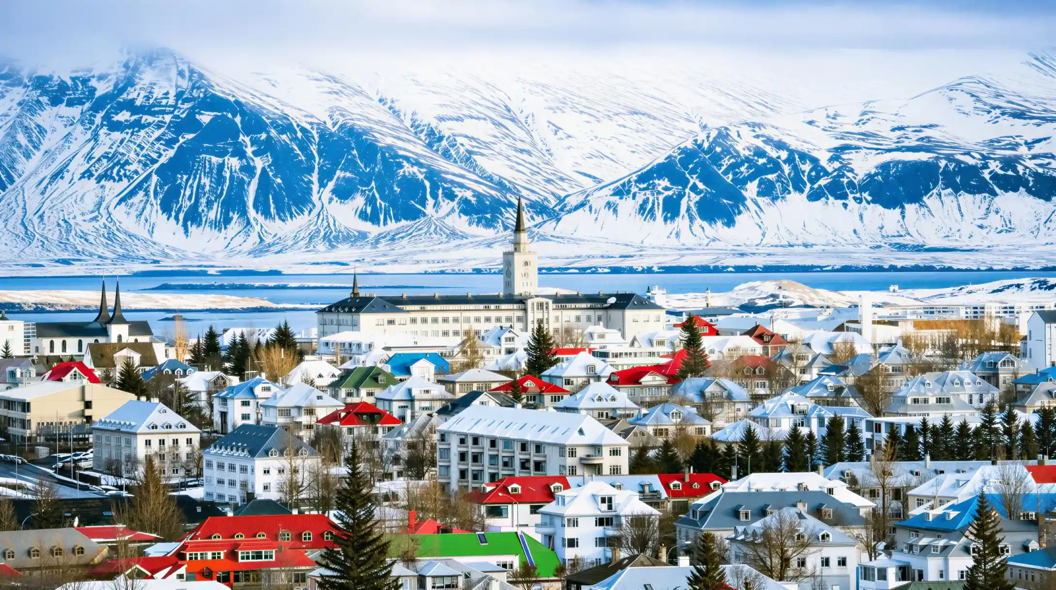

Hotel Reykjavík Grand
- Duration per the operator: duration not stated
A hotel that runs like a tour
Hotel Reykjavik Grand sits in the capital and, unusually for a hotel page in this directory, carries the shape of a day trip: it departs from Reykjavik, heads south along the coast, and reaches Vík í Mýrdal before coming back. The catalogue does not state how long the round trip runs, nor what the entry price is, so you should plan around those unknowns rather than around a fixed schedule. What the operator does commit to is food, and that is included in whatever you pay. The route itself is the classic southern shore: the city at one end, the black-sand village at the other, with the farmland and mountains of south Iceland in between. With 2,151 reviews behind it and a score of 8.4, this is a listing that many people have actually taken, which makes it a reasonable starting point if you want a hotel that also functions as a tour base.
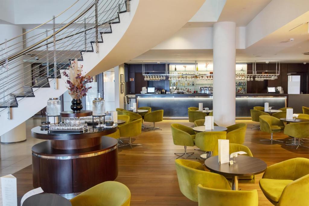
Photographs from the operator . They show the listing, not your day.
- Operator
- Duration
- duration not stated
- Departure point
- Reykjavik
- Group form
- group
- Guiding
- no guide listed
- In English
- not stated
- Pickup from your hotel
- not stated
- Price
- not stated
- Rating
- 8.4 from 2,151 ratings
- Quality bar
- passed
What is included, what is not, and what the operator does not say
The catalogue distinguishes three states, and the third matters most: not stated does not mean excluded, it means unresolved.
| Service | Status | What that means for you |
|---|---|---|
| Admission to the site | not stated | admission not stated |
| Pickup from your hotel | not stated | Not stated, so plan to make your own way. |
| Food on the tour | included | Included. |
- Status
- not stated
- What that means for you
- admission not stated
- Status
- not stated
- What that means for you
- Not stated, so plan to make your own way.
- Status
- included
- What that means for you
- Included.
Where the hotel sits in Reykjavik
The property is in Reykjavik itself, not out in the surrounding countryside. The city proper holds 139,804 people, while the greater capital region stretches to 253,230, so you are in the most densely settled part of the country. Reykjavik covers 244 square kilometres (94 square miles), which is compact for a capital, and the hotel's position inside the city means you can reach the departure point for the southern tour without a long transfer. The city was granted its charter on 18 August 1786, so the streets have had time to settle into a walkable grid. Getting about from the hotel is straightforward: you are close enough to the centre that you can walk to restaurants and shops, and if you need to go further, the bus network covers the city. For the tour itself, the coach will collect you from the hotel or from a nearby stop, and the drive south to Vík í Mýrdal takes you past the kind of open landscape that defines this part of Iceland.
What this page does not carry
The catalogue holds no operator name for this listing, so you cannot check who runs the tour before you book. It also gives no duration, no entry price, and no breakdown of what the food included in the price actually consists of. Whether it is a meal, a snack, or something in between is not recorded here. There is no mention of pickup details beyond the departure city, no information on group size, and nothing about what happens if the weather turns. The route itself is only sketched: Reykjavik at one end and Vík í Mýrdal at the other, with the stretch between them left to your imagination. If you need those specifics before committing, you will have to contact the operator directly or look elsewhere. What you do have is the review count, the score, and the certainty that food is covered, which is enough to make an informed first approach.
What an 8.4 from 2,151 reviews is worth
A score of 8.4 out of 10 is solid, but the number that matters more is the 2,151 reviews behind it. That is a large sample, which means the rating is not the product of a handful of enthusiastic guests. With that many people having stayed or travelled, the score has real weight: it tells you that most guests leave satisfied, and that the few who do not are outliers rather than a pattern. The listing has no rank in its category, because the catalogue places it in no category at all. There is no group of similar hotels or tours to measure it against, so you cannot say it is the best or worst of its kind. What you can say is that, on the strength of the reviews alone, this is a property that has consistently met expectations for a large number of visitors. If you are weighing it against an alternative with only a few dozen reviews, the size of this sample should carry more weight than the decimal point.
The day, stop by stop
The order follows the usual run of the day. Each stop names what is there and the figures behind it; everything else is in the data sheet.
Meeting point
You make your own way there; the duration counts from that point.
Reykjavik
- Population of Reykjavik (city proper)139,804Statistics Iceland
- Daylight on the June solstice21.2 hGaisma (sun-path almanac)
- Daylight on the December solstice4.1 hGaisma (sun-path almanac)
Vík í Mýrdal
- Road distance from Reykjavik186.9 kmOpenStreetMap road network, routed with OSRM
- Driving time from Reykjavik167 minOpenStreetMap road network, routed with OSRM
- Average annual rainfall2,333 mmIcelandic Meteorological Office (Veðurstofa Íslands)
Back to where you started
Back to the full list
A place on this list is a stop, not a promise about how long you spend there.
Temperatures in Reykjavik across the year
Mean daily high and mean daily low per month. Two series, one axis; the points mark the warmest and the coolest month.
There is little shelter at most of these sites. The figures are long-run outdoor averages and not a forecast.
The figures behind this chart, as a table
| Row | Jan | Feb | Mar | Apr | May | Jun | Jul | Aug | Sep | Oct | Nov | Dec |
|---|---|---|---|---|---|---|---|---|---|---|---|---|
| Daily high | 3.2 degrees C | 3.3 degrees C | 4.2 degrees C | 6.9 degrees C | 10.1 degrees C | 13 degrees C | 14.9 degrees C | 14.1 degrees C | 11.4 degrees C | 7.6 degrees C | 4.7 degrees C | 3.3 degrees C |
| Daily low | -1.7 degrees C | -1.9 degrees C | -1.3 degrees C | 1 degrees C | 4 degrees C | 7.2 degrees C | 9.1 degrees C | 8.6 degrees C | 6.2 degrees C | 2.7 degrees C | -0.1 degrees C | -1.6 degrees C |
When the southern route works best
Reykjavik's climate runs cool all year, with the warmest months being July and August, when average highs reach 15°C and 14°C respectively. June sits close behind at 13°C. From September the temperatures slide: October averages 8°C, November 5°C, and December through February hover around 3°C. The lows tell the same story, dropping to -2°C in the winter months and only rising above freezing from April onward. For a day trip that runs from the city down to Vík í Mýrdal and back, the daylight hours matter as much as the temperature. In midsummer you have nearly round-the-clock light, so a long tour does not feel rushed. In December and January, the short days mean the return leg in the dark is a real possibility, and the cold, while not extreme, will be constant. May and September offer a compromise: temperatures around 10°C and 11°C, and enough daylight for the drive. The time of day to book is the morning, so you get the maximum light on the road and arrive back before the evening chill settles in.
The full data sheet
Everything below comes from the operator's own catalogue entry or from the sources named in the last column. Where a field is blank, the operator did not fill it in, and that is recorded as unstated rather than guessed.
Download the full table as CSV · 131 rows
Show all 131 figures
| Fact | Value | Source |
|---|---|---|
| The listing26 | ||
| Operator's own title | Hotel Reykjavík Grand | Stay22 catalogue |
| Product number | 221481 | Stay22 catalogue |
| Departure point | Reykjavik | Stay22 catalogue |
| Duration | duration not stated | Stay22 catalogue |
| Multi-day | not stated | Stay22 catalogue |
| Starting price | not stated | Stay22, live check |
| Starting price in local currency | not stated | Rate 121.15 ISK to the USD |
| Rating | 8.4 out of 10 | Stay22, live check |
| Number of ratings | 2,151 | Stay22, live check |
| This project's quality bar | passed | Own rule: at least 4.0 from at least 10 ratings |
| Rank within its category | in no category | Own analysis, score weighted by the number of ratings |
| Admission to the site | not stated | Stay22 catalogue |
| Food on the tour | included | Stay22 catalogue |
| Pickup from your hotel | not stated | Stay22 catalogue |
| Kind of guiding | not stated | Stay22 catalogue |
| Guiding languages | not stated | Stay22 catalogue |
| Guide works in English | not stated | Stay22 catalogue |
| Bookable privately | not stated | Stay22 catalogue |
| Small group | not stated | Stay22 catalogue |
| Group form per the operator | hotel | Stay22 catalogue |
| Priority entry | not stated | Stay22 catalogue |
| Suitable for wheelchair users | not stated | Stay22 catalogue |
| Free cancellation | not stated | Stay22 catalogue |
| Cancellation deadline | not stated | Stay22 catalogue |
| Basis in the catalogue | not stated | Own check of the catalogue fields |
| Operator's images | 1 photographs | Stay22 catalogue |
| Reykjavik37 | ||
| Population of Reykjavik (city proper) | 139,804 | Statistics Iceland |
| Population of the greater capital region | 253,230 | Statistics Iceland |
| Area of the city | 244 km2 | Wikipedia |
| City charter granted | 18 August 1786 | Wikipedia |
| Weather station for the climate figures below | Reykjavík station (station no. 1), Icelandic Meteorological Office | Icelandic Meteorological Office (Veðurstofa Íslands) |
| Average high in January | 3.2 °C | Icelandic Meteorological Office |
| Average high in February | 3.3 °C | Icelandic Meteorological Office |
| Average high in March | 4.2 °C | Icelandic Meteorological Office |
| Average high in April | 6.9 °C | Icelandic Meteorological Office |
| Average high in May | 10.1 °C | Icelandic Meteorological Office |
| Average high in June | 13 °C | Icelandic Meteorological Office |
| Average high in July | 14.9 °C | Icelandic Meteorological Office |
| Average high in August | 14.1 °C | Icelandic Meteorological Office |
| Average high in September | 11.4 °C | Icelandic Meteorological Office |
| Average high in October | 7.6 °C | Icelandic Meteorological Office |
| Average high in November | 4.7 °C | Icelandic Meteorological Office |
| Average high in December | 3.3 °C | Icelandic Meteorological Office |
| Average low in January | -1.7 °C | Icelandic Meteorological Office |
| Average low in February | -1.9 °C | Icelandic Meteorological Office |
| Average low in March | -1.3 °C | Icelandic Meteorological Office |
| Average low in April | 1 °C | Icelandic Meteorological Office |
| Average low in May | 4 °C | Icelandic Meteorological Office |
| Average low in June | 7.2 °C | Icelandic Meteorological Office |
| Average low in July | 9.1 °C | Icelandic Meteorological Office |
| Average low in August | 8.6 °C | Icelandic Meteorological Office |
| Average low in September | 6.2 °C | Icelandic Meteorological Office |
| Average low in October | 2.7 °C | Icelandic Meteorological Office |
| Average low in November | -0.1 °C | Icelandic Meteorological Office |
| Average low in December | -1.6 °C | Icelandic Meteorological Office |
| Average annual precipitation | 875.9 mm | Icelandic Meteorological Office |
| Daylight on the June solstice | 21.2 h | Gaisma (sun-path almanac) |
| Daylight on the December solstice | 4.1 h | Gaisma (sun-path almanac) |
| Main gateway airport | KEF | Isavia |
| Drive time from Keflavik Airport to downtown Reykjavik | 45 min | Flybus (Kynnisferðir) |
| Single city bus fare (Strætó) | 690 ISK | Strætó bs |
| One-way airport bus fare (Flybus, KEF to Reykjavik) | 3,999 ISK | Flybus (Kynnisferðir) |
| Taxi fare from Keflavik Airport to Reykjavik | 22,500 ISK | Hreyfill (taxi cooperative) |
| Vík í Mýrdal19 | ||
| Population, Vík í Mýrdal locality | 740 | Statistics Iceland (Hagstofa Íslands), table MAN030102 |
| Population, Mýrdalshreppur municipality | 1,004 | Statistics Iceland (Hagstofa Íslands), table MAN02005 |
| Population passed 1,000 for the first time | Mýrdalshreppur's municipal population rose from 881 (2024) to 965 (2025) to 1,004 (2026), the first time it has passed 1,000 | Statistics Iceland (Hagstofa Íslands), table MAN02005 |
| Municipality area | 755 km2 | Wikipedia |
| Church doubles as flood evacuation point | Standing on high ground above the village, Víkurkirkja is considered one of the few buildings likely to survive a Katla-triggered glacial flood, and serves as the village's designated evacuation point | Wikipedia |
| Katla volcano, last eruption through the ice cap | 1918 (started 12 October, lasted 24 days) | Icelandic Meteorological Office (Veðurstofa Íslands) |
| Katla's historical eruption interval | About every 50 years on average from Iceland's settlement until 1918; over 100 years have now passed since the last eruption broke through the ice | Icelandic Meteorological Office (Veðurstofa Íslands) |
| Official Katla/Eyjafjallajökull civil-protection response plan | 30 September 2017 | Almannavarnir (Icelandic Civil Protection) |
| Evacuation response time built into the Katla plan | 15-20 min for Sólheimabær, up to 30 min elsewhere in the hazard zone; seismic monitoring may give 4-6 hours' warning before an eruption starts | Almannavarnir (Icelandic Civil Protection) |
| Official rockfall/snow-avalanche hazard assessment for the town | Confirmed by the Minister for the Environment on 10 February 2010, based on Veðurstofa Íslands fieldwork carried out in 2008-2009 | Icelandic Meteorological Office (Veðurstofa Íslands) |
| Average annual rainfall | 2,333 mm | Icelandic Meteorological Office (Veðurstofa Íslands) |
| Wettest year on record | 2,887 mm | Icelandic Meteorological Office (Veðurstofa Íslands) |
| Single-day rainfall record | 150.3 mm | Icelandic Meteorological Office (Veðurstofa Íslands) |
| Highest temperature on record | 28.5 C | Icelandic Meteorological Office (Veðurstofa Íslands) |
| Lowest temperature on record | -16.9 C | Icelandic Meteorological Office (Veðurstofa Íslands) |
| Ranking among Iceland's weather stations | One of Iceland's two warmest weather stations for the year as a whole, together with Vestmannaeyjar | Icelandic Meteorological Office (Veðurstofa Íslands) |
| Hotel rooms in the village | 1,400 | Wikipedia |
| Road distance from Reykjavik | 186.9 km · Computed over the OpenStreetMap road network, not quoted from a tour operator. Driving only: no stops, no ferry, no winter closures, and a car rather than a coach that has to load forty people at every stop. | OpenStreetMap road network, routed with OSRM |
| Driving time from Reykjavik | 167 min · Computed over the OpenStreetMap road network, not quoted from a tour operator. Driving only: no stops, no ferry, no winter closures, and a car rather than a coach that has to load forty people at every stop. | OpenStreetMap road network, routed with OSRM |
| Sources: Þingvellir National Park27 | ||
| Park entry fee, adult | 0 ISK | Arctic Adventures |
| Parking fee, car (up to 5 seats) | 1,000 ISK | Þingvellir National Park |
| Toilet fee | 0 ISK | Iceland Review |
| Visitor centre opening hours | 09:00-18:00 (Apr-Oct), 09:00-17:00 (Nov-Mar) | Þingvellir National Park |
| Park access season | Grounds open 24 hours, year-round | Arctic Adventures |
| Visitor centre exhibition fee, adult | 1,200 ISK | Þingvellir National Park |
| UNESCO World Heritage status since | 2,004 | UNESCO World Heritage Centre |
| Althing (Icelandic parliament) established | 930 | Þingvellir National Park |
| Year Althing stopped meeting at Thingvellir | 1,798 | Þingvellir National Park |
| National park established | 1,930 | Þingvellir National Park |
| Core protected area | 92.7 km2 | Wikipedia |
| Lake Þingvallavatn surface area | 84 km2 | Wikipedia |
| Lake Þingvallavatn, maximum depth | 114 m | Wikipedia |
| Tectonic plate drift rate | 2 cm/year | Þingvellir National Park |
| Silfra fissure water temperature | 2-4 C | Þingvellir National Park |
| Silfra fissure, maximum diving depth allowed | 18 m | Þingvellir National Park |
| Silfra diving/snorkeling park fee, per person | 1,500 ISK | DIVE.IS |
| Campsite fee, adult per night | 1,800 ISK | Þingvellir National Park |
| Campsite season | Summer season Jun 1-Sep 15; Nyrðri-Leirar open year-round | Þingvellir National Park |
| Wheelchair accessibility | Paved and boardwalk paths from parking lots P1, P2, P4 and P5 reach the main sights; lot P3's path is steep and unsuitable | Golden Circle Iceland |
| Safety warning | Snow can hide cracks and rifts near the Öxará riverbank; visitors are told to stay on marked paths | Þingvellir National Park |
| Recent path closure | Part of the Almannagjá gorge path closed evenings 18:00-23:00 through end of May for bridge repairs | Þingvellir National Park |
| Öxarárfoss waterfall height | 12 m | Iceland Review |
| Þingvallakirkja church built | 1,859 | Iceland Review |
| Women executed at Drekkingarhylur drowning pool | 18 | Iceland Review |
| Road distance from Reykjavik | 47.6 km · Computed over the OpenStreetMap road network, not quoted from a tour operator. Driving only: no stops, no ferry, no winter closures, and a car rather than a coach that has to load forty people at every stop. | OpenStreetMap road network, routed with OSRM |
| Driving time from Reykjavik | 47 min · Computed over the OpenStreetMap road network, not quoted from a tour operator. Driving only: no stops, no ferry, no winter closures, and a car rather than a coach that has to load forty people at every stop. | OpenStreetMap road network, routed with OSRM |
| Sources: Geysir geothermal area22 | ||
| Entry fee to the geothermal area | 0 ISK | Reykjavík Grapevine |
| Parking fee, car | 1,000 ISK | Reykjavík Grapevine |
| Access season | Open-air site accessible year-round, no gate or hours | Environment Agency of Iceland |
| Protected area size | 3 km2 | Environment Agency of Iceland |
| Protected as a natural monument since | 2,020 | Environment Agency of Iceland |
| Identified thermal features in the area | 364 | Wikipedia |
| Elevation | 110 m | Wikipedia |
| Strokkur eruption interval | 6-10 min | Wikipedia |
| Strokkur eruption height, typical | 15-20 m | Wikipedia |
| Strokkur eruption height, maximum recorded | 40 m | Wikipedia |
| Great Geysir, last known eruption | 2,016 | Iceland Review |
| Great Geysir, tallest eruption on record | 170 m | Wikipedia |
| Water temperature in the geyser conduit | 85-95 C | Wikipedia |
| First written record of Geysir | 13th century | Environment Agency of Iceland |
| Land donated to the Icelandic nation | 1,935 | Environment Agency of Iceland |
| Recent change: footpath and safety project | Circular footpath and safety upgrade, phase one finished Sep 2024, full project due by end of 2025 | Environment Agency of Iceland |
| Safety warning | Stay on the marked paths and behind ropes; geyser water reaches 100C at the surface and can scald or kill | Guide to Iceland |
| Wheelchair accessibility | Main paths around Strokkur are level, compact gravel or paved and usable by wheelchair in good weather; the upper hill viewpoint has steps and steep sections | Golden Circle Iceland |
| Historic royal visits marked by stone markers | Danish kings Christian IX (1874), Frederick VIII (1907) and Christian X (1921) visited and are commemorated by carved 'king's stones' | Environment Agency of Iceland |
| Origin of the English word 'geyser' | Derived from Geysir, this valley's most famous spring; entered English usage in 1780 | Etymonline |
| Road distance from Reykjavik | 115.3 km · Computed over the OpenStreetMap road network, not quoted from a tour operator. Driving only: no stops, no ferry, no winter closures, and a car rather than a coach that has to load forty people at every stop. | OpenStreetMap road network, routed with OSRM |
| Driving time from Reykjavik | 104 min · Computed over the OpenStreetMap road network, not quoted from a tour operator. Driving only: no stops, no ferry, no winter closures, and a car rather than a coach that has to load forty people at every stop. | OpenStreetMap road network, routed with OSRM |
Similar tours on this site
Six listings a reader of this page is genuinely torn between: same departure point first, then the same destinations, then a similar length. Each card leads to a page with the same data sheet rather than straight to the operator, so you can compare before you book.
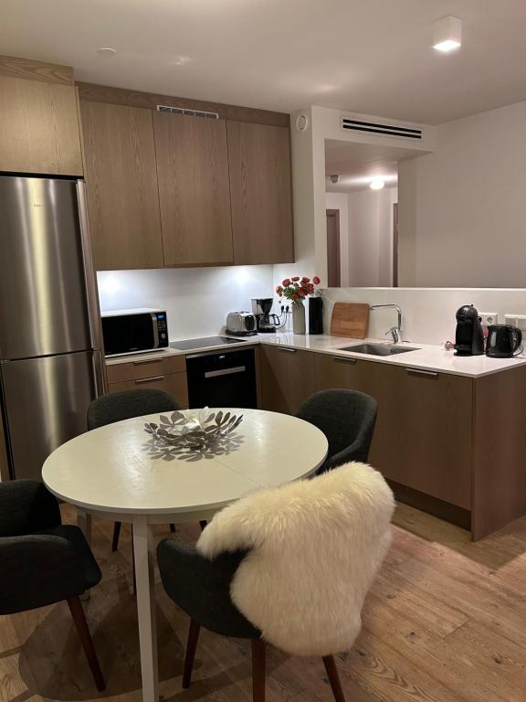

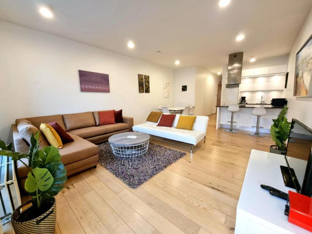
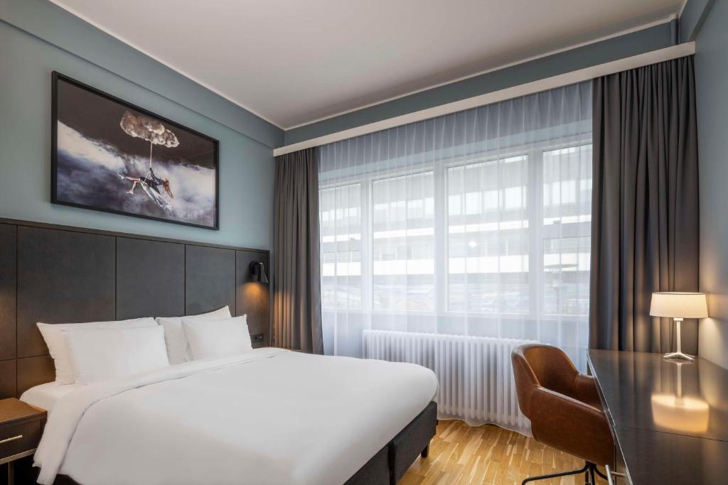

The order follows how close a listing is to this one, not the commission. Ratings, prices and availability according to GetYourGuide, accessed on . Prices in US dollars; “from” is the provider's lowest entry price.
Common questions
Is admission included?
The catalogue does not say. Where the route is waterfalls and beaches there is nothing to pay; ask if it includes a paid attraction.
How long does the place to stay really take?
The catalogue gives duration not stated. That is the operator's own figure and covers the tour itself, not the time you spend getting to the meeting point.
Is there a guide who works in English?
The catalogue does not say. The field is empty, which is not a no; ask before booking.
Where do I find all the data on this place to stay?
In the data sheet on this page. It carries every field on the tour, on each place it visits and on the climate of the departure city, each with its source, and it downloads as a CSV.
Does this listing's rating mean anything?
Yes. 8.4 out of 10 from 2,151 is above the bar this site holds, which is 8.0 out of 10 from at least ten voices.
Hotel Reykjavík Grand
Dates, remaining places and the current version of what is included are at the operator. This page reflects the state of the catalogue, not the state of this morning.
Sources
Every figure on this page comes from one of these sources. The running text does not name them, so that it stays readable; the data sheet carries the source in every row.
- 1Stay22: Hotel Reykjavík GrandTitle, duration, what is included, languages, cancellation deadline, stars, number of ratings and starting price.
- 2This project's exchange-rate record, partners/fx.json accessed 2026-09-07Prices are shown in USD as published, with an approximate ISK figure at the rate on the date given. The operator charges in its own currency.
- 3Statistics Iceland accessed 2026-09-07
- 4Statistics Iceland accessed 2026-09-07
- 5Wikipedia accessed 2026-09-07
- 6Icelandic Meteorological Office (Veðurstofa Íslands) accessed 2026-09-07
- 7Icelandic Meteorological Office accessed 2026-09-07
- 8Gaisma (sun-path almanac) accessed 2026-09-07
- 9Isavia accessed 2026-09-07
- 10Flybus (Kynnisferðir) accessed 2026-09-07
- 11Strætó bs accessed 2026-09-07
- 12Hreyfill (taxi cooperative) accessed 2026-09-07
- 13Statistics Iceland (Hagstofa Íslands), table MAN030102 accessed 2026-09-07
- 14Statistics Iceland (Hagstofa Íslands), table MAN02005 accessed 2026-09-07
- 15Wikipedia accessed 2026-09-07
- 16Wikipedia accessed 2026-09-07
- 17Icelandic Meteorological Office (Veðurstofa Íslands) accessed 2026-09-07
- 18Almannavarnir (Icelandic Civil Protection) accessed 2026-09-07
- 19Almannavarnir (Icelandic Civil Protection) accessed 2026-09-07
- 20Icelandic Meteorological Office (Veðurstofa Íslands) accessed 2026-09-07
- 21Icelandic Meteorological Office (Veðurstofa Íslands) accessed 2026-09-07
- 22OpenStreetMap road network, routed with OSRM accessed 2026-09-07
- 23Statistics Iceland accessed 2026-09-07
- 24Wikipedia accessed 2026-09-08
- 25Icelandic Meteorological Office accessed 2026-09-07
- 26Arctic Adventures accessed 2026-09-07
- 27Þingvellir National Park accessed 2026-09-07
- 28Iceland Review accessed 2026-09-07
- 29UNESCO World Heritage Centre accessed 2026-09-07
- 30DIVE.IS accessed 2026-09-07
- 31Golden Circle Iceland accessed 2026-09-07
- 32Reykjavík Grapevine accessed 2026-09-07
- 33Environment Agency of Iceland accessed 2026-09-07
- 34Guide to Iceland accessed 2026-09-07
- 35Etymonline accessed 2026-09-07